


  |
|
This
site built & maintained by
Vision
Exploration LLC
Comments?
Contact Us
©
Copyright 2020
Vision Exploration / MGS
All rights reserved
|
To read
the E-Bulletin, you need to use the free
Adobe Reader. To download: click the
icon below and follow the instructions. |

|
|
|
MGS Noon Luncheon
Schedule 2019 - 2020 |
|
Notice - Noon
Luncheon cost is $20 per person.
Members, Guests &
Visitors -
Please note that the
Noon Luncheon
dates
are in the
left
column. |
|
The Mississippi
Geological Society (MGS) and the Society of
Petroleum Engineers (SPE) now sponsor joint monthly
meetings for their members. MGS members should note that the
dates of the combined MGS/SPE monthly meetings have now been
moved to the second Wednesday of each month.
The meeting venue is unchanged. To learn more about the
Meetings, dates and speakers, please check the Meetings calendar and
the latest MGS Bulletin. Unless otherwise
noted below, all MGS/SPE Noon Luncheon Meetings are held at the
River Hills
Club located at the intersection of Lakeland Drive and Ridgewood
Road in north
Jackson, Mississippi (note - entrance to the parking lot on east side
of Ridgewood Road). |
|
MGS
Noon Luncheon Dates |
MGS Officers Meeting
Dates |
|
2019 |
2019 |
|
Sept. 13 (Fall BBQ) |
September 10 |
|
October 11 |
October 8 |
|
November 8 |
November 12 |
|
[Break] |
[Break] |
|
2020 |
2020 |
|
January
8 |
January 7 |
|
February 12 |
February 11 |
|
March 11 |
March 10 |
|
April 8 |
April 7 |
|
May 13
(Spring Fling) |
May 12 |

|
Abstracts - Selected Past MGS Presentations
Abstract -
2020 January MGS/SPE Noon Luncheon
The Jackson Gas Rock, a Unique Upper Cretaceous (Selma Chalk)
Lithofacies
Speaker:
Steve Walkinshaw
Vision Exploration, LLC
January 8, 2020
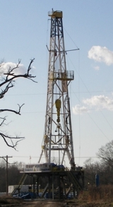
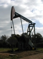
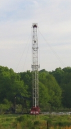
The Jackson Gas Field was officially discovered in 1930 with the
drilling and completion of the Jackson Oil & Gas Co. #1 Mayes in
Section 2, Township 5 North, Range 1 East, Hinds County,
Mississippi, in a carbonate reservoir informally named the
“Jackson Gas Rock”.
The discovery well flowed gas with an open-flow potential of 15
MMCFGPD from a heavily karsted interval at the top of the Upper
Cretaceous (Selma) Chalk.
While the heavily karsted chalk reservoir produced 119 BCF
of methane gas at Jackson Gas Field, a hydraulically-separated
quartzitic sandstone deposited unconformably at the top of the
Selma Chalk comprises the 7.6 MMBO (26 degree API gravity) oil
reservoir that is stratigraphically trapped in the Flora Field
area. A small volume
of heavy (13.6 degree API gravity) oil has also been produced from
the karsted Gas Rock chalk reservoir on the southern flank of the
Dome, in the vicinity of the city of Pearl.
In 1957, two years after the last producing Gas Rock gas
well had been shut in, the crestal area of the Jackson Gas Field
was converted to a gas storage reservoir and is still used for
that purpose today, 61 years later.
The study area for this presentation encompassed 848 wells drilled
within an area of approximately 1,465 square miles located in
Hinds, Madison, Rankin and Yazoo Counties in west-central
Mississippi. In addition to detailed subsurface mapping, lithology
data pertaining specifically to the Jackson Gas Rock facies was
derived from the analysis of a subset of 126 wells for which
mudlog, sample log, core and/or sidewall core descriptions or
analyses were available.
Cores and samples from several key wells were also
examined. Bottom-hole
temperature data available for 446 wells (as recorded in each log
header) was also collected and analyzed to determine if a
significant deviation from the “normal” subsurface geothermal
gradient was present within the study area, and specifically,
within the known perimeter of the Jackson Dome uplift.
The recent acquisition of high resolution 3D seismic and
gravity data has shed new light on the origin and provenance of
the Dome and this data is revealed for the first time in this
presentation.
Subsurface mapping and 3D seismic interpretation indicates the
Jackson Gas Rock facies represents a relatively pure chalky
limestone deposited in a persistent syncline that had initially
formed in the area surrounding the Dome in early Jurassic time.
While thin lenses of framestones, boundstones and shell
hash have been sporadically encountered within the overall Gas
Rock interval, such occurrences are rare; and, while the most
common fossiliferous lenses appear to be comprised of rudist shell
fragments disseminated in a chalk matrix, a ubiquitous buff to
white-colored leached chalk is clearly the predominant
lithofacies. The
thickest Gas Rock interval encountered to date (1,702’) was
deposited within the deepest portion of the northern syncline in
Township 8 North, Range 1 East in southern Madison County.
In certain areas of west-central Mississippi, underlying the Gas
Rock facies, a black micaceous clay containing water-lain
volcaniclastics and thin beds of ash is associated with a period
of vulcanism that was widespread across the south-central Texas,
central Arkansas, northeastern Louisiana and west-central
Mississippi areas during Austin Chalk time.
This vulcanism appears to have been “locally” centered in
the Sunflower Ridge area, in the eastern Mississippi Delta.
The Austin-age volcaniclastics overlie a normal Mesozoic
sedimentary sequence that was frequently intruded by magma in a
broad area that extends from Monroe to Jackson, an area that
includes the Monroe-Sharkey Platform and four other domal
structures that are very similar in size, shape and origin to the
Jackson Dome.
Comparisons of these five domes to the actual nexus of igneous
activity in Mississippi are presented and the aerial extent of the
Mesozoic volcaniclastic sediments in the State is revealed for the
first time.
Steve Walkinshaw is
an independent petroleum geologist and the owner and manager of
Vision Exploration, LLC.
Steve graduated from Millsaps College in 1981 and is a
Registered Professional Geologist in the State of Mississippi, a
Licensed Professional Geoscientist in the State of Louisiana, and
an AAPG/DPA Certified Petroleum Geologist.
Steve is the only Mississippi-based geologist that has
served as technical consultant to two major Tuscaloosa Marine
Shale ("TMS") operators and has lectured extensively on the TMS at
numerous industry and academic venues.
In addition, Steve served as presenter for the
Unconventional Brown Dense Lime Trend at numerous shale
conferences and professional society meetings from 2011 to 2015.
Steve is a long-standing member and has served as Chairman
of the Mississippi State Mapping Advisory Committee (SMAC) since
2017. In addition to
holding numerous other officer positions, he has served as past
President of the Mississippi Geological Society and has been the
Society’s webmaster since 2002.
This presentation
was awarded the 2018 First Place Thomas A. Philpott
Excellence of Presentation Award by the Gulf Coast
Association of Geological Societies (GCAGS).
The Philpott Excellence of Presentation Award was last
awarded to a Mississippi-based petroleum geologist (Dudley Hughes)
in 1960.
Steve has many oil
and gas discoveries and successful field redevelopment projects to
his credit, primarily in South and East Louisiana, Mississippi and
Alabama.
Abstract -
2014 January Noon Luncheon
Hydrofracking: Are
Mississippi Operators
And E&P Professionals
Prepared
For the Environmental
Risk?
Speaker: John M. Ryan,
Senior Geologist
Allen Engineering and Science
January 9, 2014
Advances in
directional well drilling and reservoir stimulation (i.e.,
hydrofracking) techniques have revolutionized the effectiveness of
economically producing oil and gas (O&G) within rock once
considered too tight and/or deep to exploit.
Unfortunately, the exponential successes that have come
from these advances have in some regard been offset by significant
controversy from a variety of different regulatory agencies and
environmental advocacy groups.
The hydraulic fracturing treatments used to stimulate
production from unconventional formations have stirred
environmental concerns over excessive water consumption, drinking
water well contamination, and surface water contamination from
both drilling activities and management of the fracturing (i.e.,
frac) fluid. We will
examine some of the key regulatory and advocacy issues besieging
the O&G industry in states away from Mississippi and discuss
whether operators working or considering working within
Mississippi are prepared for the elevated risk and negative
exposure associated with the play.
|
|
|
Abstract -
2008 January Noon Luncheon
The Revitalization of
Sligo Field
Prior to the formation of Greystone Petroleum
LLC and its development of Sligo Field, located in Bossier
Parish, Louisiana, Michael Geffert and Joe Bridges drilled and
completed over 200 wells in Lower Cretaceous and Upper Jurassic
reservoirs located in the Ark-La-Tex. Though these were
primarily Hosston wells located on turtle structures in the
North Louisiana Salt Basin, their experience in mapping,
drilling and completing the Rodessa, Pettit, Hosston, Cotton
Valley and Smackover reservoirs led them to the observation that
completion procedures followed by Pennzoil and other operators
at Sligo Field left many gas charged reservoirs either behind
pipe or bypassed below packers and cast iron bridge plugs.
Abstract -
2007
April Noon Luncheon
The Global Warming
Controversy
The hype
and fear associated with the global warming issue has become a
driving force behind many aspects of our daily life and work.
Government officials at all levels are making decisions that
affect business, environmental controls, international treaties,
taxes, political campaigns, and social policies based on “global
warming”. The Intergovernmental Panel on Climate Change (IPCC)
has just released the 2007 update of its “Physical Science Basis
Summary for Policy Makers”. Amid the hype, news agencies are
using the issue to create headlines designed to cause alarm (and
boost ratings). Yet, is the science sound? Is there consensus
that human activities are causing global climate change? Is
there an underlying agenda? What if the doomsayers are right?
What if they are wrong?
These are
all questions that we as geoscientists are likely asking
ourselves. Yet, anyone who tries to figure out the answers may
quickly become overwhelmed with the flood of information
available on the internet or elsewhere in print. Because of all
the hype and distortion, it is difficult to get down to a simple
evaluation of the scientific facts. This presentation attempts
to provide a reasoned and balanced evaluation of the issue from
a geologist’s perspective. The presenter believes that
geologists are uniquely qualified to understand and lead the
debate on the global climate change issue, and it is our duty as
earth science professionals to be involved in advancing the
public understanding of the issue.
Ken
Ruckstuhl is a graduate of LSU and is a registered professional
geologist. He works in the Jackson office of Environmental
Management Services, Inc. He has worked in the environmental
consulting field for 25 years.
Abstract -
2007
February Noon Luncheon
Petrophysical Evaluation of
Gas-Shale Reservoirs
Typically, geologists and engineers
work to develop a data set to define reservoir potential and
establish a drilling strategy that will provide optimum results.
The evaluation of shale reservoirs combines the evaluation of
several important parameters and includes petrophysical (core
and logs), petrographic, geochemical and mechanical property
data. All data types are important in defining reservoir
potential, targeting zones with the greatest potential and for
comparing shale reservoirs from different provinces. Unless all
key parameters are favorable, it is unlikely that economic
production can be achieved. This presentation will discuss
each key element’s importance in understanding productive
potential and outline evaluation efforts necessary to properly
characterize a gas-shale reservoir.
Chuck Segrest received his geology
degree from Baylor University.
He has over 25 years industry
experience in petrophysical evaluation of rock samples for the
purposes of improved reservoir characterization.
He is a senior partner in the
company GeoSystems, which is geological/petrophysics company
specializing in the integration of multiple data sets for the
purpose of improved reservoir characterization.
Abstract - November
2006 Noon Luncheon
"Exploration Strategies for Thrombolite and
Associated Facies, Eastern Gulf Coastal Plain"
Ernest A. Mancini, Center for
Sedimentary Basin Studies and Department of Geological Sciences,
University of Alabama
In the eastern
Gulf Coastal Plain, Upper Jurassic Smackover inner ramp (shallow
water) thrombolite buildups have been documented as developing
on paleotopographic features (Paleozoic basement paleohighs or
Jurassic salt anticlines and ridges). Thrombolites dominated by
calcimicrobes grew in the eastern part of the Mississippi
Interior Salt Basin, the Manila Subbasin and the Conecuh
Subbasin. These thrombolites attained a thickness of 58 m and
are present in an area of up to 6.2 square km. Although these
buildups have been exploration targets for some 30 years, new
field discoveries continue to be made in this area indicating
that the development of these organosedimentary deposits is not
completely understood.
Recent hydrocarbon drilling in Little Cedar Creek Field, Conecuh
County, southwest Alabama has revealed that the productive
reservoir rocks are thrombolite boundstone and associated
nearshore grainstone and packstone that occur near the
depositional updip limit of the Upper Jurassic Smackover
Formation. These thrombolite buildups do not directly overlie
Paleozoic basement paleohighs.
By studying Upper
Jurassic thrombolite bioherms and reefs as preserved in outcrop,
the geometries, aerial extents, and facies relationships of
thrombolites can be better characterized, and this
characterization is useful in designing an effective exploration
strategy for delineating thrombolite buildups in the subsurface.
Thrombolites were best developed on a hard substrate during a
rise in sea level under initial zero to low background
sedimentation rates in low energy paleoenvironments, and their
occurrence was not restricted by water depth, salinity,
temperature, light penetration, oxygen content, or nutrient
supply. The keys to drilling a successful wildcat well in the
thrombolite reservoir play prior to the discovery of Little
Cedar Creek Field were to: 1) utilize three-dimensional seismic
reflection technology to find a paleohigh and to determine
whether potential thrombolite reservoir facies occur on the
crest and/or flanks of the feature and are above the oil-water
contact, 2) use the characteristics of thrombolite bioherms and
reefs as observed in outcrop to develop a three-dimensional
geologic model to reconstruct the growth of thrombolite buildups
on paleohighs for improved targeting of the preferred dendroidal
and chaotic thrombolite reservoir facies, and 3) utilize the
evaporative pumping mechanism, rather than the seepage reflux or
mixing zone models, as a means for assessing potential
dolomitization of the thrombolite boundstone.
The operative Smackover petroleum system at Little Cedar Creek
has shown that the current thrombolite exploration strategy
requires revision to include: consideration of a basin center
petroleum source in addition to a local source, the development
of potential reservoir facies in a broader array of
paleobathymetric settings other than restricted to inner to
middle ramp, inclusion of moldic and vuggy pore types to
intercrystalline dolomite pore types for a productive reservoir,
lime mudstone and shale as vertical and lateral seal rocks
rather than anhydrite, and stratigraphic traps in addition to
combination structural and stratigraphic traps. |
|
|
Abstract - April
2006 Noon Luncheon
|
|
"The
Mississippi Sound:
A View from
the West Side"
Bob Schneeflock,
Paramount
Petroleum
The possible leasing of the
Mississippi Sound has been highly controversial, to say the very
least. “The Sound’s” geologic potential has mostly been
viewed from the Miocene and Norphlet successes of offshore
Alabama to the east, Mariner field to the North, and the Miocene
and James Lime successes in the Federal waters to the south.
The April Noon luncheon presentation touched on those plays,
but focused on a possible extension of the
significant Miocene productive trend from the west, in Southeast
Louisiana, into the Mississippi Sound area. As an example,
a recent well that targeted one of the 3D bright spots located
in Southeast Louisiana, adjoining “The Sound”, flowed for months
at over 70 mmcfgPd
(pipeline constrained) from a Middle Miocene "Chris I" sand.
Seismic exploration in that area also revealed an unconformity
on the scale of the Grand Canyon, along with the imaging of
additional gas pay sands that were trapped beneath it.
|
|
|
Abstract - January
2006 Noon Luncheon
|
|
"The Barnett Shale Play of North Texas:
Myths Exposed, Truths Revealed"
Kent A. Bowker, Bowker Petroleum LLC
Many Barnett
workers have an incorrect understanding of the Barnett reservoir
of the Fort Worth Basin. No one has a complete understanding of
exactly how this unconventional reservoir actually works, but
we have enough understanding to know that many of the ideas held
by some Barnett workers are incorrect. For example, the Barnett
is naturally fractured, but only a tiny fraction of these
fractures are open. The Barnett is not a fractured-shale play;
it’s a shale that can be fractured play (Daniel Miller). In
fact, areas that have the most natural fractures (again, the
vast majority of these fractures are healed), i.e., areas near
faulting, have the lowest production. The huge concentration of
gas in place is what makes the Barnett successful, along with
the rock’s mechanical properties (that it is relatively
brittle). Structural folds (including anticlines) are, on
average, detrimental to Barnett production. The thermal history
of the basin is another key to the success of the play. The gas
is entirely thermogenic. Limestone beds within the Barnett are
the result of submarine debris flows (turbidities), not by
shoaling. Carbonate nodules seen in core and on image logs are
the result of soft-sediment processes; they are not
concretions. The core area of Newark East field is not a
sweetspot, it is just the first area that Mitchell Energy
started drilling (because that is where Mitchell had existing
acreage and infrastructure).
One man is
solely responsible for the success of the Barnett play:
George P. Mitchell.
|
|
|
Unless otherwise
noted above, all MGS Noon Luncheon Meetings are held at the
River Hills
Club
located at the intersection of Lakeland Drive and Ridgewood
Road in north
Jackson, Mississippi (note - entrance to the parking lot on east side
of Ridgewood Road). |
|
|
|
Next Meeting
February
Noon
Luncheon
February 12
River
Hills
Club
|
|
 We're always looking
for a good Noon Speaker.
We're always looking
for a good Noon Speaker.
Got a good presentation? Maybe you
just attended a great talk or lecture. We'd like to hear from you!
Please contact any of our officers or MGS committee chairmen and
tell us more about it. The Society is always looking for good
Speakers to give technical presentations at its Monthly Noon
Luncheons. In most instances, we can help defray
some or all of the travel costs
incurred in coming to Jackson for the presentation. Thanks! |
|
|