


| Links Of Interest |
| Regional/National: |
| GCAGS |
| AAPG |
| SEPM |
| PTTC |
| FLIPPA |
| Well Records/Data: |
| MOG - Energy |
| Oil & Gas Boards: |
| Mississippi |
| Alabama |
| Louisiana (DCE) |
| Louisiana (LGS) |
| Florida (FGS) |
| Neighbor Societies: |
| Alabama |
| Baton Rouge |
| Shreveport |
| New Orleans |
| Lafayette (No Website) |
| Houston |
| South Texas |
| Austin |
| Corpus Christi |
| East Texas |
|
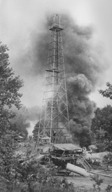
| The testing of the #1 Woodruff, the first commercial oil well drilled in Mississippi (discovery well for the 230 MMBO Tinsley Field), in 1939 (photo by Frank Noone) |
© 2026 Mississippi Geological Society. All rights reserved.
Maintained and updated by the Mississippi Geological Society
Originally developed by
Vision Exploration LLC
|
|||
|
|||
|
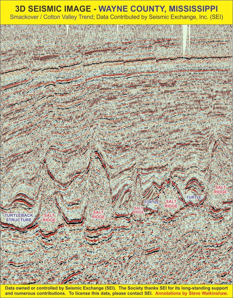
The 3D line shown above is from the Wayne County area of southeast Mississippi, an area where numerous deep salt ridges and turtleback anticlines dominate the Jurassic structural setting. Hydrocarbons have been discovered and produced from both crestal and flank traps developed along the ridges and "turtles". Data courtesy Seismic Exchange. To view all 14 sample 3D and 2D seismic lines covering various areas of the subsurface of Mississippi, click here. |
|||
| MGS members are committed to the highest standards of Professional Ethics. | |||
| Check out the Energy Information Administration's excellent website! |


|
| Workover Rig at Wellsite |
|
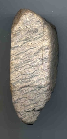
| Pre-loess porphyritic rhyolite cobble clast exhibiting typical flow-banding structures. The phenochrysts visible in this specimen have been badly weathered resulting in pitting on the outer surfaces. The presence of unusual clasts like this can help differentiate the Pre-loess Terrace Deposits of the ancestral Mississippi River from the Pliocene Terrace Deposits in Southwest Mississippi. This specimen is from Clear Creek, a tributary of the Big Black River in Warren County, near the town of Bovina. |
|
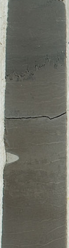
| Portion of diamond core cut across the upper Brown Dense Limestone of the Smackover Formation, in Columbia County, Arkansas |
